places in Schiedam
Netherlands
Schiedam
Schiedam
Administrative Region:
South Holland
population:
77 999
calling code:
+31-10
postcode:
3100-3102
3109
3111-3119
3121-3125
Location on the map of Netherlands
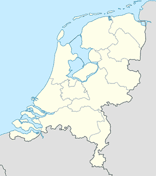
Schiedam
Police
Politiebureau Schiedam
Bijdorpplein 1, Schiedam
Police
read more
Route
Achtererf 34-32
Schiedam
Route
read more
Subway station
Schiedam Centrum
Netherlands
Subway station
read more
Schiedam Nieuwland
Netherlands
Subway station
read more
Troelstralaan
Netherlands
Subway station
read more
Parkweg Station
Netherlands
Subway station
read more
Pernis
Netherlands
Subway station
read more
Troelstralaan Station
Netherlands
Subway station
read more
Marconiplein
Netherlands
Subway station
read more
Bakery
Bakker Klootwijk
Hof van Spaland 50, Schiedam
Bakery
read more
Olivia's Bakery
Slot Assumburgpad 64, Schiedam
Bakery
read more
MultiVlaai
Hof van Spaland 54, Schiedam
Bakery
read more
Bakkerij Het Westen
Netherlands
Bakery
read more
Bakkerij Gözde
Borodinlaan 62, Schiedam
Bakery
read more
Stadsbakkerij Schiedam
Stationsplein 3, Schiedam
Bakery
read more
Bakker Ammerlaan (Winkelcentrum Hof van Spaland)
Hof van Spaland 23, Schiedam
Bakery
read more
Banketbakkerij Scholtes
Monseigneur Nolenslaan 694, Schiedam
Bakery
read more
Bakker Klootwijk
Passage 21, Schiedam
Bakery
read more
Broodbakkerij Hicret VOF
Monseigneur Nolenslaan 414, Schiedam
Bakery
read more
Zumrut Banketbakkerij
Vlaardingerstraat 7, Schiedam
Bakery
read more
Co”peratieve Inkoopvereniging van Brood- en Banketbakkerspatroons "Civoba I." B.A.
Ringersstraat 10, Schiedam
Bakery
read more
Broodboetiek J & L Belder
Jan Steenstraat 1-A, Schiedam
Bakery
read more
Pita Delicatessen Cakes
Hoogstraat 82, Schiedam
Bakery
read more
Bakkerij Kapris
Groenelaan 64-C, Schiedam
Bakery
read more
Department store
Vintage 'Lein
Hoogstraat 86A, Schiedam
Department store
read more
HEMA
Nieuwe Passage 43, Schiedam
Department store
read more
Kijkshop.nl
Nieuwe Passage 14, Schiedam
Department store
read more
📑
Schiedam all categories
Accounting
Administrative area level 2
Art gallery
Atm
Bakery
Bank
Bar
Beauty salon
Bicycle store
Book store
Bowling alley
Bus station
Cafe
Car dealer
Car rental
Car repair
Car wash
Casino
Cemetery
Church
Clothing store
Convenience store
Courthouse
Dentist
Department store
Doctor
Electrician
Electronics store
Embassy
Finance
Fire station
Florist
Food
Funeral home
Furniture store
Gas station
General contractor
Grocery or supermarket
Gym
Hair care
Hardware store
Health
Home goods store
Hospital
Insurance agency
Jewelry store
Laundry
Lawyer
Library
Light rail station
Liquor store
Local government office
Lodging
Meal delivery
Meal takeaway
Mosque
Movie rental
Movie theater
Moving company
Museum
Natural feature
Night club
Painter
Park
Parking
Pet store
Pharmacy
Physiotherapist
Place of worship
Plumber
Point of interest
Police
Post office
Premise
Real estate agency
Restaurant
Roofing contractor
Route
Rv park, camping
School
Shoe store
Shopping mall
Spa
Stadium
Storage
Store
Subway station
Supermarket
Train station
Transit station
Travel agency
University
Veterinary care
sublocality level 2
↑