places in Heerlen
Coronavirus disease (COVID-19) Situation
confirmed cases
8635786
deaths
22992
Netherlands
Heerlen
Heerlen
Administrative Region:
Limburg
population:
67 910
calling code:
+31-45
postcode:
6400-6401
6411-6419
6421-6422
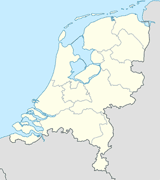
Location on the map of Netherlands
Heerlen
Meal takeaway
Broodje Pani
Kasteellaan 106, Heerlen
Meal takeaway
read more
AbuSassie
Willemstraat 105, Heerlen
Meal takeaway
read more
McDonald's Heerlen Woonboulevard
Breukerweg 200, Heerlen
Meal takeaway
read more
Snackworld
Eikenderweg 49, Heerlen
Meal takeaway
read more
McDonald's Heerlen
Bongerd 1, Heerlen
Meal takeaway
read more
Jin Poo
Raadhuisstraat 118, Hulsberg
Meal takeaway
read more
McDonald's Landgraaf
Brunssummerweg 138, Landgraaf
Meal takeaway
read more
Big Snack Landgraaf
Oude Landgraaf 53, Landgraaf
Meal takeaway
read more
Friture Johnny
Monseigneur Hanssenlaan 81-A, Hoensbroek
Meal takeaway
read more
Mosque
HDV KUBA Moskee
Eikenderweg 79A, Heerlen
Mosque
read more
Централна джамия на Хеерлен
Eikenderweg 81, Heerlen
Mosque
read more
Stichting Moskee Nour Heerlen
Kempkensweg 10, Heerlen
Mosque
read more
Movie rental
Ster Media Store Hoensbroek
Nieuwstraat 46-A, Hoensbroek
Movie rental
read more
Erotheek XXL
Langeberglaan 1, Brunssum
Movie rental
read more
Movie theater
Filmhuis de Spiegel
Bongerd 18, Heerlen
Movie theater
read more
Quatro Cinema
Geleenstraat 9, Heerlen
Movie theater
read more
Natural feature
Sint Jansbosch
Valkenburg
Natural feature
read more
Tempsplein
Heerlen
Natural feature
read more
Geul
Wijlre
Natural feature
read more
Imstenraderbos
Heerlen
Natural feature
read more
Caumerbeek
Heerlen
Natural feature
read more
Prins Willem Alexanderplein
Hulsberg
Natural feature
read more
Gerendal
Schin op Geul
Natural feature
read more
DäölkesBerg
Valkenburg
Natural feature
read more
Kisselsbos
Landgraaf
Natural feature
read more
Sousberg
Schin op Geul
Natural feature
read more
📑
Heerlen all categories
Accounting
Administrative area level 2
Amusement park
Aquarium
Art gallery
Atm
Bakery
Bank
Bar
Beauty salon
Bicycle store
Book store
Bowling alley
Bus station
Cafe
Campground
Car dealer
Car rental
Car repair
Car wash
Casino
Cemetery
Church
City hall
Clothing store
Convenience store
Dentist
Department store
Doctor
Electrician
Electronics store
Finance
Fire station
Florist
Food
Funeral home
Furniture store
Gas station
General contractor
Grocery or supermarket
Gym
Hair care
Hardware store
Health
Home goods store
Hospital
Insurance agency
Jewelry store
Laundry
Lawyer
Library
Liquor store
Local government office
Locality
Locksmith
Lodging
Meal delivery
Meal takeaway
Mosque
Movie rental
Movie theater
Moving company
Museum
Natural feature
Night club
Painter
Park
Parking
Pet store
Pharmacy
Physiotherapist
Plumber
Point of interest
Police
Post office
Premise
Real estate agency
Restaurant
Roofing contractor
Route
Rv park, camping
School
Shoe store
Shopping mall
Spa
Stadium
Storage
Store
Subpremise
Supermarket
Taxi stand
Train station
Transit station
Travel agency
University
Veterinary care
Zoo
↑