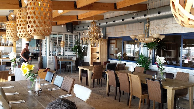
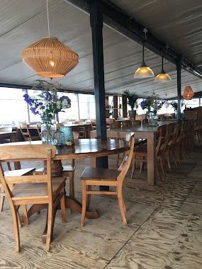
Restaurant nearby Restaurant De Goudvis
Coronavirus disease (COVID-19) Situation
confirmed cases
8635786
deaths
22992
Netherlands
Restaurant nearby Restaurant De Goudvis
Restaurant De Goudvis
Zeeweg 91, Sint Maartensvlotbrug Nederland
contacts phone
:
+31
Latitude:
52.7915903
, Longitude:
4.6876766
read more
nearest Restaurant
54 m
O3 Vis & Friet smz
De Zeeweg 83, Sint Maartensvlotbrug
Restaurant
read more
291 m
Eeterij Drinkerij Duinerij
Westerduinweg 30, Sint Maartensvlotbrug
Restaurant
read more
941 m
O Sole Mio V.o.f.
Zeeweg 33, Sint Maartensvlotbrug
Restaurant
read more
1.056 km
Strandpaviljoen NewZuid Sint Maartenszee
Burgemeester Breebaartweg 1, Sint Maartensvlotbrug
Restaurant
read more
1.105 km
Strandpaviljoen Noord
Sint Maartensvlotbrug
Restaurant
read more
1.261 km
Sint Maartenszee
Belkmerweg 65, Sint Maartensvlotbrug
Restaurant
read more
1.367 km
Strandpaviljoen Noord
Zeeweg 1, Sint Maartensvlotbrug
Restaurant
read more
2.633 km
Restaurant Buiten
Spreeuwendijk 4, Petten
Restaurant
read more
2.909 km
Vis- en Snackrestaurant Moritz
Ketelduinweg 1, Petten
Restaurant
read more
3.033 km
Brasserie Restaurant Zo Gewoon
Plein 1945 1A, Petten
Restaurant
read more
3.126 km
Pizzeria Bella Napoli
Plein 1945 14, Petten
Restaurant
read more
3.848 km
Restaurant de Watersnip
Pettemerweg 4, Petten
Restaurant
read more
3.88 km
China Wok Schagerbrug
Rijksweg 55, Schagerbrug
Restaurant
read more
3.929 km
Strandpavilioen Zilte Zucht
Callantsoog
Restaurant
read more
4.414 km
Eetcafé Halfweg
Burgerweg 9, Burgerbrug
Restaurant
read more
4.58 km
Theetuin Dijkzicht
Wijzendweg 16, Sint Maarten
Restaurant
read more
4.867 km
Brasil
Dorpsplein 12, Callantsoog
Restaurant
read more
4.892 km
Wip-in
Dorpsplein 5, Callantsoog
Restaurant
read more
4.898 km
Café De TAV
Dorpsplein 7, Callantsoog
Restaurant
read more
4.912 km
The 4 Seasons
Dorpsplein 13, Callantsoog
Restaurant
read more
4.934 km
O3 Vis & Friet
Dorpsplein 17, Callantsoog
Restaurant
read more
4.946 km
Grand Cafe De Foyer
Dorpsplein 21, Callantsoog
Restaurant
read more
4.947 km
Rondom Gelukkig
Grote Sloot 351, Schagerbrug
Restaurant
read more
4.949 km
IEGEWIES eten & drinken
Dorpsplein 21b, Callantsoog
Restaurant
read more
5.017 km
Dorpszicht
Dorpsweg 2, Callantsoog
Restaurant
read more
📑
all categories
Accounting
Administrative area level 1
Administrative area level 2
Airport
Amusement park
Aquarium
Art gallery
Atm
Bakery
Bank
Bar
Beauty salon
Bicycle store
Book store
Bowling alley
Bus station
Cafe
Campground
Car dealer
Car rental
Car repair
Car wash
Casino
Cemetery
Church
City hall
Clothing store
Colloquial area
Convenience store
Country
Courthouse
Dentist
Department store
Doctor
Electrician
Electronics store
Embassy
Establishment
Finance
Fire station
Florist
Food
Funeral home
Furniture store
Gas station
General contractor
Grocery or supermarket
Gym
Hair care
Hardware store
Health
Hindu Temple
Home goods store
Hospital
Insurance agency
Jewelry store
Laundry
Lawyer
Library
Light rail station
Liquor store
Local government office
Locality
Locksmith
Lodging
Meal delivery
Meal takeaway
Mosque
Movie rental
Movie theater
Moving company
Museum
Natural feature
Neighborhood
Night club
Painter
Park
Parking
Pet store
Pharmacy
Physiotherapist
Place of worship
Plumber
Point of interest
Police
Political
Post office
Premise
Real estate agency
Restaurant
Roofing contractor
Route
Rv park, camping
School
Shoe store
Shopping mall
Spa
Stadium
Storage
Store
Subpremise
Subway station
Supermarket
Synagogue
Taxi stand
Train station
Transit station
Travel agency
University
Veterinary care
Zoo
administrative area level 3
administrative area level 4
sublocality level 1
sublocality level 2
↑